The Legacy Trail
By car, there are only three routes north south through Osprey, Florida.
- I-75
- Honore Ave.
- Tamiami Trail (US-41).
Now, bicyclists have an alternative for north south travel. Built over former CSX railroad tracks, The Legacy Trail travels more than 10 miles from Palmer Ranch in Sarasota to the historic Train Depot in Venice, FL.
About The Trail
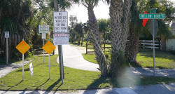
The Legacy Trail covers the entire length of the town of Osprey, FL in Sarasota County. The trail is not lighted and is open from dawn to dusk. If you're bringing your bicycle on a car rack and want to park near the trail there are seven parking areas you can use.-
Culverhouse Nature Park in Sarasota
7301 McIntosh Rd., Sarasota, FL -
Osprey Junction Trailhead
939 E. Bay St., Osprey, FL -
Laurel Park
509 Collins Rd., Laurel, FL -
Nokomis Community Park
234 Nippino Trl E., Nokomis, FL -
Oscar Scherer State Park
1843 S Tamiami Trl, Osprey, FL -
Patriots Park
800 Venetia Bay Blvd., Venice, FL -
Historic Venice Train Depot
303 E. Venice Ave., Venice, FL
At the northern end of the Legacy Trail the county has opened a parking lot at the Central County Utilities site on McIntosh Road just south of Palmer Ranch Parkway in Sarasota.
A little farther south you can enter the trail through Oscar Scherer Park. Spending the day at the park and enjoying the Legacy Trail is probably the ideal way to appreciate the natural area the Legacy Trail traverses.
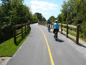
Biking early in the day is best when there is lots of shade available from the many trees that border the trail. There are rest spots every mile along the trail.
A lot of wildlife and not so wild life, in the form of cattle, can be seen along the trail.

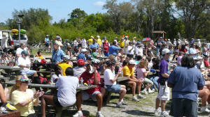
Hundreds of cyclists gathered in Oscar Scherer State Park for the dedication of the Legacy Trail in March of 2008.
Being a railroad track traveling through rural Florida, there were of course streams and other waterways to cross.
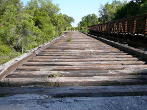
Adjacent to one of the trail bridges is the train trestle that was part of the original Seaboard Air Line Railroad built in early 1900. The SAL controlled 2,600 miles of track stretching from Virginia to Florida. In 1911 SAL constructed a 16.5 mile extension from Sarasota to Venice. The bridge over South Creek is one of the remaining trestles in built in 1911.
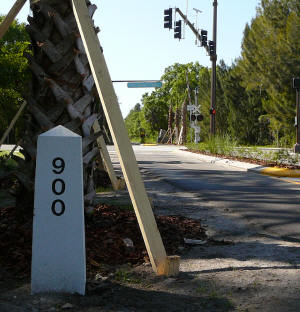
The trestle pictured above is located at mile-marker 897.6. As you travel along the trail, note the mile markers present to reflect the original railroad mile markers starting from north to south.
The last of the trestles over Dona Bay in Nokomis in Sarasota County has been completed.
Keep in mind, there are no water sources along the trail, except at the Venice end at the Venice Train Depot so be sure to bring along your own supply of liquids. Remember, if you're starting your trail ride at the end of the trail in either Sarasota or Venice, when you reach Osprey or Nokomis, you're not very far from some local dining and drinking options. Just south of the Laurel Road crossing the access at the fitness trail puts you very close to Tamiami Trail and the shopping center near Laurel Road which includes several restaurants and bars. Also, in Osprey you are very close to another group of dining options just a couple of miles from the trail or even closer from the Oscar Scherer Park entrance.